

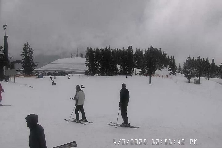
Timberline Ski Resort
Timberline Lodge
Elevation: 6,000'
Wind: @ mph
Wind Chill: °F
24-Hour Snow: 0"
Base: 1"

Mt Hood Meadows
Elevation: 5,380'
Wind: @ mph
Wind Chill: °F
24-Hour Snow: 0"
Base: 0"
Skibowl
Elevation: 5,010'
Wind: WSW @ 9.0 mph
Wind Chill: 36°F
24-Hour Snow: 0"
Base: 0"

View Government Camp 7 Day ![]()
Tuesday

Heavy Rain
46°/48°
Wednesday

Rain and Breezy
46°/48°
Thursday

Rain
43°/47°
Friday

Slight Chance Rain
39°/50°
Saturday
Chance Rain
39°/52°
Sunday
Rain Likely
40°/43°
Monday
Rain
40°/48°
Tuesday: Rain. The rain could be heavy at times. High near 48. West wind around 6 mph becoming light and variable. Winds could gust as high as 18 mph. Chance of precipitation is 100%. New precipitation amounts between 1 and 2 inches possible.
Tuesday Night: Rain. The rain could be heavy at times. Low around 46. Breezy, with a west wind 10 to 16 mph, with gusts as high as 39 mph. Chance of precipitation is 100%. New precipitation amounts between 1 and 2 inches possible.
Wednesday: Rain, mainly after 10am. High near 48. Breezy, with a west southwest wind 10 to 16 mph, with gusts as high as 37 mph. Chance of precipitation is 90%. New precipitation amounts between a quarter and half of an inch possible.
Wednesday Night: Rain. Low around 46. West southwest wind around 10 mph, with gusts as high as 28 mph. Chance of precipitation is 80%. New precipitation amounts between a quarter and half of an inch possible.
Thursday: Rain, mainly before 4pm. High near 47. Chance of precipitation is 80%.
Thursday Night: A 40 percent chance of rain, mainly before 10pm. Mostly cloudy, with a low around 43.
Friday: A slight chance of rain. Partly sunny, with a high near 50.
Friday Night: A slight chance of rain before 10pm. Mostly cloudy, with a low around 39.
Saturday: A chance of rain, mainly after 4pm. Partly sunny, with a high near 52.
Saturday Night: Rain likely. Mostly cloudy, with a low around 39.
Sunday: Rain likely. Snow level 5500 feet. Mostly cloudy, with a high near 43.
Sunday Night: Rain likely. Snow level 5800 feet. Mostly cloudy, with a low around 40.
Monday: Rain. Cloudy, with a high near 48.

Government Camp Hwy 26
4026’
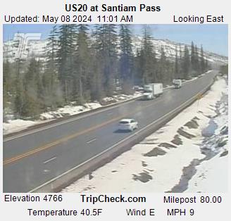
Santiam Pass Hwy 20
4817’
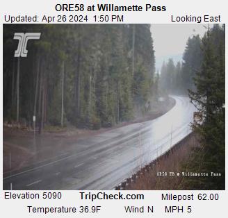
Willamette Pass Hwy 58
5128’
Siskiyou Pass I-5
4310’
Snoqualmie Pass I-90
3022’
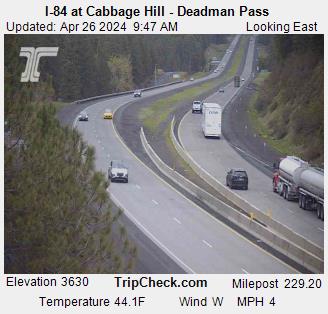
Cabbage Hill I-84
3620’
Coast Range Hwy 26
1600’
Murphy Hill Hwy 18
760’
Dudlee Hill Hwy 20
860’
 )
)
 )
)
 )
)
 )
)
 )
)
 )
)
 )
)
 )
)
 )
)
 )
)
 )
)
 )
)